
Executive Development Programme in Remote Sensing Applications in Geophysics
Master remote sensing for geophysics, gaining advanced skills to drive innovation and solve complex geological challenges effectively.
Executive Development Programme in Remote Sensing Applications in Geophysics
Programme Summary
This Executive Development Programme delivers advanced instruction in the integration of satellite imagery and geophysical data analysis for senior professionals in the energy, mining, and environmental sectors. Participants engage with cutting-edge methodologies for interpreting subsurface structures through high-resolution remote sensing technologies. The curriculum targets experienced geoscientists, project managers, and technical directors seeking to enhance their strategic decision-making capabilities using spatial data analytics. Learners examine case studies involving seismic survey integration and mineral exploration workflows to understand practical applications in complex geological settings.
Attendees master the technical competencies required to process multi-spectral and thermal infrared data for accurate geological mapping. The programme emphasises proficiency in Geographic Information Systems (GIS) software tailored for geophysical modelling and resource estimation. Students develop critical analytical skills to correlate surface spectral signatures with subsurface lithological variations, thereby improving exploration success rates. Participants also learn to assess data quality and uncertainty metrics, ensuring robust interpretations that withstand rigorous peer review and regulatory scrutiny.
Graduates emerge equipped to lead high-value exploration projects that leverage remote sensing for reduced environmental impact and cost efficiency. This qualification positions professionals to advise executive boards on technology-driven strategies for sustainable resource management and risk mitigation. Alumni typically assume leadership roles in geoscience departments, driving innovation in data integration and operational excellence. The programme fosters a network of industry experts, facilitating collaboration on large-scale infrastructure and environmental monitoring initiatives across global markets.
Learning Outcomes
The Executive Development Programme in Remote Sensing Applications in Geophysics offers senior professionals a rigorous examination of advanced geospatial technologies. This course bridges the critical gap between theoretical geophysics and practical data interpretation, equipping leaders with the analytical tools necessary to navigate complex subsurface environments. Participants engage with cutting-edge methodologies, transforming raw satellite and aerial imagery into actionable strategic intelligence for resource management and environmental monitoring.
Curriculum depth ensures mastery of essential topics, including multi-spectral image processing, synthetic aperture radar (SAR) interpretation, and the integration of geophysical survey data with Geographic Information Systems (GIS). Learners explore the nuances of thermal infrared sensing for mineral exploration and utilise machine learning algorithms to enhance anomaly detection in seismic datasets. The programme emphasises hands-on application, requiring delegates to solve real-world problems related to groundwater assessment, tectonic hazard mapping, and infrastructure stability analysis.
Graduates emerge capable of leading high-stakes projects that demand precision and foresight. They apply these refined skills to optimise exploration workflows, reduce operational risks, and ensure regulatory compliance in increasingly scrutinised industries. By synthesising remote sensing data with traditional geophysical models, professionals can make informed decisions that balance economic viability with environmental stewardship.
Career trajectories for alumni span diverse sectors, including energy, mining, civil engineering, and government consultancy. Participants often assume roles such as Chief Geophysicist, Technical Director, or Strategic Advisor, where they drive innovation in data-driven decision-making. The programme fost
Programme Features
Industry-Aligned Curriculum
Developed with industry leaders for job-ready skills
Globally Recognised Certificate
Recognised by employers across 180+ countries
Flexible Online Learning
Study at your own pace with lifetime access
Instant Access
Start learning immediately, no application process
Constantly Updated Content
Latest industry trends and best practices
Career Advancement
87% report measurable career progression within 6 months
Course Modules
- Geophysical Fundamentals: Reviews core principles of geophysics and their intersection with remote sensing technologies.: Remote Sensing Data Acquisition: Examines satellite and aerial platforms, sensor types, and data collection methodologies.
- Image Processing and Analysis: Covers techniques for preprocessing, enhancing, and interpreting remote sensing imagery.: Integration of Geophysical and Remote Sensing Data: Explores methods for combining subsurface geophysical data with surface remote sensing information.
- Case Studies in Exploration and Monitoring: Analyzes real-world applications in mineral exploration, hydrogeology, and environmental monitoring.: Strategic Management and Future Trends: Discusses project management, ethical considerations, and emerging technologies in the field.
What's Included in This Programme
Here is what you get when you enrol with LSBR London
Programme Facts
Audience: Senior geoscientists and technical leaders.
Prerequisites: Advanced degree in geophysics required.
Outcomes: Master remote sensing for exploration.
Ready to advance your career?
Join thousands of professionals who have transformed their careers with LSBR London. Enrol today and start learning immediately.
Why Study This Programme
Pursuing the Executive Development Programme in Remote Sensing Applications in Geophysics offers a strategic advantage for professionals seeking to future-proof their careers within the energy and environmental sectors. This programme addresses the critical industry shift towards data-driven decision-making by bridging the gap between theoretical geophysics and practical satellite technology.
Participants acquire advanced competencies in processing multi-spectral and radar imagery, enabling them to interpret subsurface structures with unprecedented precision. This technical mastery directly enhances project efficiency, reducing exploration risks and associated costs for multinational corporations.
The curriculum emphasises the integration of artificial intelligence with remote sensing data. Graduates learn to deploy machine learning algorithms for automated anomaly detection, a skill set that is increasingly vital for competitive bidding in international tenders. This capability positions leaders as innovators capable of driving digital transformation within their organisations.
Attendees develop a nuanced understanding of regulatory compliance and environmental monitoring through remote sensing. This knowledge ensures that projects adhere to stringent global sustainability standards, thereby mitigating legal risks and enhancing corporate social responsibility profiles.
The programme fosters a robust professional network comprising industry leaders and academic experts. Such connections provide invaluable insights into emerging market trends and facilitate collaborative opportunities, accelerating career progression into senior executive roles.
By investing in this specialised training, professionals secure a distinct competitive edge, aligning their expertise with the evolving demands of the modern geophysical landscape.
"This programme gave me the confidence and credentials to secure a senior role. Highly recommend LSBR London."
— Sarah M., United Kingdom
Course Brochure
Download our comprehensive course brochure with all details
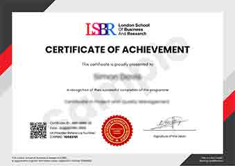
Sample Certificate
Preview the certificate you'll receive upon successful completion of this program.
Get Course Info
Receive the full course guide, pricing details, and enrolment instructions directly in your inbox.
Check your inbox!
Course details have been sent to your email.
Get Your Employer to Sponsor This Programme
Many employers offer professional development budgets. We make it easy for your company to invest in your growth with corporate invoicing and bulk enrolment options.
Email Template for Your Manager
Dear [Manager's Name],
I would like to request sponsorship for the Executive Development Programme in Remote Sensing Applications in Geophysics programme offered by LSBR London - Executive Education.
The programme costs $199 (one-time) and can be completed in 3-4 weeks alongside my regular duties.
Key benefits to our team:
- Immediately applicable skills
- Globally recognised certificate
- Corporate invoice available
Best regards,
[Your Name]
What Our Students Say
Hear from our students about their experience with the Executive Development Programme in Remote Sensing Applications in Geophysics at LSBR London - Executive Education.
Charlotte Williams
United Kingdom"The curriculum provided a deep dive into advanced satellite data processing techniques that immediately enhanced my ability to interpret complex geophysical datasets. Mastering these remote sensing applications has significantly boosted my confidence in handling real-world environmental monitoring projects."
Rahul Singh
India"The program’s focus on integrating remote sensing data with geophysical models gave me the technical confidence to lead complex subsurface analysis projects immediately after graduation. This specialized expertise not only streamlined our exploration workflows but also positioned me for a senior role in resource management within months."
Mei Ling Wong
Singapore"The logical progression of modules seamlessly integrated theoretical geophysics with practical remote sensing techniques, making complex concepts accessible and actionable. This structured approach significantly enhanced my ability to apply advanced data analysis methods to real-world geological challenges, directly boosting my professional confidence and technical expertise."
Your Certification Journey
Four simple steps from enrolment to your globally recognised certificate
Enrol Online
Complete your enrolment in under 2 minutes with secure checkout
Start Learning
Get instant access to all course materials and start at your own pace
Complete Modules
Work through the curriculum with expert support available throughout
Get Certified
Receive your LSBR London certificate recognised across 180+ countries
LSBR London by the Numbers
Join a global community of professionals advancing their careers
Students Enrolled
Countries Represented
Average Rating
Career Progression