
Postgraduate Certificate in Interactive Mapping Techniques for GIS
Enhance GIS skills with this certificate, focusing on interactive mapping techniques to boost career prospects in geographic information systems.
Postgraduate Certificate in Interactive Mapping Techniques for GIS
Programme Summary
The Postgraduate Certificate in Interactive Mapping Techniques for GIS is designed for professionals and students seeking to enhance their skills in using advanced mapping technologies to analyze and visualize spatial data. This program focuses on the integration of Geographic Information Systems (GIS) with interactive mapping tools, equipping learners with the ability to create, manage, and analyze complex spatial data sets. The curriculum includes hands-on training with industry-standard software such as ArcGIS Pro and QGIS, as well as an exploration of the latest techniques in web-based mapping and geospatial analysis.
Key skills and knowledge developed throughout the program include the ability to design and implement interactive web maps, perform spatial analysis using advanced GIS tools, and integrate various data sources for comprehensive mapping solutions. Learners will also gain proficiency in using scripting languages like Python for automating GIS tasks and enhancing data manipulation capabilities. These skills are essential for creating dynamic, user-friendly maps that can be used for decision-making in fields such as urban planning, environmental management, and public health.
This program significantly impacts learners' career trajectories by preparing them for roles in GIS and spatial analysis. Graduates are well-equipped to work in sectors requiring advanced GIS skills, such as urban planning agencies, environmental consulting firms, and government organizations. They can also pursue careers in data science, where their expertise in interactive mapping and spatial analysis is highly valued. The program’s focus on practical applications ensures that graduates are ready to contribute effectively in their chosen fields.
Learning Outcomes
The Postgraduate Certificate in Interactive Mapping Techniques for GIS is designed to equip professionals with advanced skills in Geographic Information Systems (GIS) and interactive mapping technologies. This program is ideal for those seeking to enhance their spatial analysis capabilities and explore innovative mapping solutions. By focusing on cutting-edge tools and methodologies, participants learn to create dynamic, interactive maps that tell compelling stories and provide actionable insights.
Key topics include vector and raster data manipulation, spatial analysis, web mapping technologies like ArcGIS Online and Leaflet, and the integration of GIS with other data sources. Through hands-on projects and real-world case studies, students gain practical experience in designing and implementing interactive mapping solutions for urban planning, environmental management, public health, and more.
Graduates are well-prepared to take on roles such as GIS Analysts, Environmental Planners, or Data Scientists, where they can leverage their skills to make informed decisions based on spatial data. Employers in government agencies, non-profits, and private industries value graduates who can translate complex data into accessible, interactive maps that drive impact. This program not only enhances technical skills but also fosters a deep understanding of how spatial data can shape policies and improve lives.
Programme Features
Industry-Aligned Curriculum
Developed with industry leaders for job-ready skills
Globally Recognised Certificate
Recognised by employers across 180+ countries
Flexible Online Learning
Study at your own pace with lifetime access
Instant Access
Start learning immediately, no application process
Constantly Updated Content
Latest industry trends and best practices
Career Advancement
87% report measurable career progression within 6 months
Course Modules
- Foundational Concepts: Covers the core principles and key terminology.: Spatial Data Management: Focuses on data storage, retrieval, and manipulation.
- Geospatial Analysis: Explores techniques for analyzing spatial data.: Interactive Web Mapping: Teaches the creation and implementation of web maps.
- Remote Sensing Applications: Introduces remote sensing technologies and their GIS applications.: Project Development: Involves planning and executing a GIS project.
What's Included in This Programme
Here is what you get when you enrol with LSBR London
Programme Facts
Audience: GIS professionals, data analysts
Prerequisites: Bachelor's degree, GIS fundamentals
Outcomes: Master mapping techniques, spatial analysis skills
Ready to advance your career?
Join thousands of professionals who have transformed their careers with LSBR London. Enrol today and start learning immediately.
Why Study This Programme
Enhance Career Opportunities: Acquiring a Postgraduate Certificate in Interactive Mapping Techniques for GIS can significantly widen career prospects. It equips professionals with advanced skills in geographic information systems (GIS), making them more competitive in fields such as urban planning, environmental management, and public health. Employers value candidates who can use GIS tools to analyze spatial data, which is crucial for informed decision-making.
Advanced Spatial Analysis Skills: The program focuses on interactive mapping techniques, which are essential for conducting sophisticated spatial analysis. Participants learn to work with large datasets, apply GIS tools to solve real-world problems, and create interactive maps that can be used for presentations, reports, and decision support. These skills are highly valued in industries that require data-driven insights.
Industry-Relevant Curriculum: The certificate program is designed in collaboration with industry experts, ensuring that the curriculum remains relevant to current and emerging trends in GIS. Students learn the latest software and tools, such as ArcGIS Pro and QGIS, which are widely used in the industry. This not only enhances their technical skills but also improves their ability to stay updated with technological advancements.
Networking and Professional Development: The program often provides opportunities for networking with industry professionals and experts in GIS. This can lead to valuable connections and potential job offers. Additionally, the certificate can serve as a stepping stone for further education or advanced certifications, such as the Esri Certified Professional (ECP) designation, which can further elevate one's professional profile.
"This programme gave me the confidence and credentials to secure a senior role. Highly recommend LSBR London."
— Sarah M., United Kingdom
Course Brochure
Download our comprehensive course brochure with all details
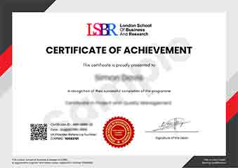
Sample Certificate
Preview the certificate you'll receive upon successful completion of this program.
Get Course Info
Receive the full course guide, pricing details, and enrolment instructions directly in your inbox.
Check your inbox!
Course details have been sent to your email.
Get Your Employer to Sponsor This Programme
Many employers offer professional development budgets. We make it easy for your company to invest in your growth with corporate invoicing and bulk enrolment options.
Email Template for Your Manager
Dear [Manager's Name],
I would like to request sponsorship for the Postgraduate Certificate in Interactive Mapping Techniques for GIS programme offered by LSBR London - Executive Education.
The programme costs $149 (one-time) and can be completed in 3-4 weeks alongside my regular duties.
Key benefits to our team:
- Immediately applicable skills
- Globally recognised certificate
- Corporate invoice available
Best regards,
[Your Name]
What Our Students Say
Hear from our students about their experience with the Postgraduate Certificate in Interactive Mapping Techniques for GIS at LSBR London - Executive Education.
Sophie Brown
United Kingdom"The course content is incredibly comprehensive, covering advanced mapping techniques that are directly applicable in real-world GIS projects. I've gained substantial practical skills, particularly in creating interactive maps and spatial analysis, which have significantly enhanced my career prospects in the field."
Kavya Reddy
India"This postgraduate certificate has significantly enhanced my ability to create interactive maps that are not only visually appealing but also highly functional for data analysis. It has opened up new career opportunities in the GIS industry, particularly in roles that require advanced mapping skills."
Priya Sharma
India"The course structure is well-organized, providing a comprehensive overview of interactive mapping techniques that directly enhances my understanding and application of GIS in real-world scenarios, significantly boosting my professional growth."
Your Certification Journey
Four simple steps from enrolment to your globally recognised certificate
Enrol Online
Complete your enrolment in under 2 minutes with secure checkout
Start Learning
Get instant access to all course materials and start at your own pace
Complete Modules
Work through the curriculum with expert support available throughout
Get Certified
Receive your LSBR London certificate recognised across 180+ countries
LSBR London by the Numbers
Join a global community of professionals advancing their careers
Students Enrolled
Countries Represented
Average Rating
Career Progression