
Advanced Certificate in Land Cover Classification Techniques
Master advanced land cover classification techniques to enhance remote sensing to drive precise environmental monitoring and informed decision-making.
Advanced Certificate in Land Cover Classification Techniques
Programme Summary
The Advanced Certificate in Land Cover Classification Techniques provides rigorous training in remote sensing and geospatial data analysis for environmental consultants, urban planners, and government officials. This intensive curriculum addresses the critical need for accurate land monitoring in an era of rapid climate change and urban expansion. Participants engage with satellite imagery processing, machine learning algorithms, and ground-truthing methodologies to interpret complex terrestrial data. The programme suits professionals seeking to transition from traditional surveying methods to automated, high-resolution classification systems. It delivers a comprehensive framework for understanding spectral signatures, spatial resolution limits, and temporal dynamics within diverse ecosystems.
Learners acquire proficiency in operating industry-standard software such as ArcGIS and QGIS for advanced image segmentation and feature extraction. Students master the application of supervised and unsupervised classification algorithms, including Random Forest and Support Vector Machines, to enhance mapping accuracy. The course emphasises the validation of classification results through rigorous statistical analysis and error matrix interpretation. Participants develop the ability to integrate multi-source data, combining optical, thermal, and radar imagery for robust land cover assessments. Graduates learn to manage large-scale geospatial datasets efficiently, ensuring reproducibility and transparency in their analytical workflows.
Completion of this certificate significantly enhances employability in sectors ranging from agricultural management to conservation biology. Professionals gain a competitive edge by demonstrating expertise in evidence-based land use planning and environmental impact assessment. Employers value candidates who can translate raw satellite data into actionable strategic insights for policy development. Graduates are well-positioned for senior roles in
Learning Outcomes
The Advanced Certificate in Land Cover Classification Techniques offers a rigorous exploration of remote sensing methodologies, equipping professionals with the analytical precision required to interpret complex geospatial data. This programme distinguishes itself through its integration of traditional photogrammetry with cutting-edge machine learning algorithms, ensuring participants remain at the forefront of environmental monitoring technology. Candidates will engage with high-resolution satellite imagery, mastering the classification of diverse terrestrial and aquatic environments using both supervised and unsupervised learning models.
Core modules delve into spectral analysis, object-based image processing, and the validation of classification accuracy using ground-truth data. Participants will also examine the ethical and legal frameworks surrounding land use planning, ensuring that technical expertise is applied within robust regulatory contexts. The curriculum emphasises practical application, requiring students to complete a capstone project that addresses real-world challenges in urban development, agriculture, or conservation management.
Graduates emerge with the capability to transform raw satellite data into actionable intelligence for stakeholders across multiple sectors. They apply these skills to monitor deforestation rates, assess flood risks, and optimise crop yields through precision agriculture techniques. The versatility of these competencies opens doors to senior roles within government environmental agencies, international non-governmental organisations, and private geospatial consultancies. Professionals may pursue positions as Senior Remote Sensing Analysts, Geospatial Data Scientists, or Environmental Consultants, driving strategic decisions based on accurate, up-to-date land cover information.
By bridging the gap between theoretical remote sensing principles and industrial application, this certificate
Programme Features
Industry-Aligned Curriculum
Developed with industry leaders for job-ready skills
Globally Recognised Certificate
Recognised by employers across 180+ countries
Flexible Online Learning
Study at your own pace with lifetime access
Instant Access
Start learning immediately, no application process
Constantly Updated Content
Latest industry trends and best practices
Career Advancement
87% report measurable career progression within 6 months
Course Modules
- Remote Sensing Data Fundamentals: Introduces satellite and aerial imagery sources, spectral characteristics, and data preprocessing requirements.: Preprocessing and Correction Techniques Details atmospheric correction, geometric registration, and radiometric normalization methods.
- Feature Extraction and Selection Explores methods for deriving spectral, textural, and spatial features to enhance classification accuracy.: Supervised Classification Algorithms Covers traditional machine learning approaches such as Random Forest, SVM, and Maximum Likelihood.
- Deep Learning for Land Cover Examines convolutional neural networks and transformer models for automated feature learning and segmentation.: Accuracy Assessment and Validation Teaches protocols for generating error matrices, calculating Kappa coefficients, and reporting classification performance.
What's Included in This Programme
Here is what you get when you enrol with LSBR London
Programme Facts
Audience: Geospatial analysts and environmental scientists.
Prerequisites: Basic GIS proficiency and statistics.
Outcomes: Master remote sensing data interpretation.
Ready to advance your career?
Join thousands of professionals who have transformed their careers with LSBR London. Enrol today and start learning immediately.
Why Study This Programme
Pursuing the Advanced Certificate in Land Cover Classification Techniques offers a strategic advantage for professionals navigating the increasingly complex landscape of environmental data science. This programme is meticulously designed to bridge the gap between theoretical remote sensing principles and practical, industry-standard application, ensuring graduates possess the technical acumen required for high-level decision-making.
The curriculum provides rigorous training in machine learning algorithms tailored for satellite imagery, enabling practitioners to automate classification processes with unprecedented accuracy. This technical proficiency directly translates to enhanced operational efficiency within consultancy firms and government agencies, allowing for rapid processing of large-scale geospatial datasets.
Participants develop critical analytical skills in validating classification outputs against ground-truth data. This capability ensures that environmental impact assessments and urban planning strategies are grounded in reliable evidence, thereby mitigating regulatory risks and fostering stakeholder confidence in project outcomes.
The certificate significantly bolsters professional credibility by demonstrating mastery of current industry software, such as ENVI and ArcGIS Pro. Employers increasingly prioritise candidates who can immediately contribute to complex mapping projects without extensive onboarding, making this qualification a powerful differentiator in a competitive job market.
Graduates gain the expertise to interpret land-use changes over time, a skill vital for climate change adaptation strategies. This forward-looking perspective positions professionals as key advisors in sustainability initiatives, driving policy development and resource management strategies that align with global environmental goals.
"This programme gave me the confidence and credentials to secure a senior role. Highly recommend LSBR London."
— Sarah M., United Kingdom
Course Brochure
Download our comprehensive course brochure with all details
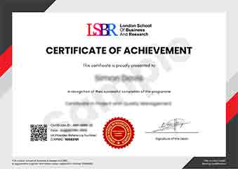
Sample Certificate
Preview the certificate you'll receive upon successful completion of this program.
Get Course Info
Receive the full course guide, pricing details, and enrolment instructions directly in your inbox.
Check your inbox!
Course details have been sent to your email.
Get Your Employer to Sponsor This Programme
Many employers offer professional development budgets. We make it easy for your company to invest in your growth with corporate invoicing and bulk enrolment options.
Email Template for Your Manager
Dear [Manager's Name],
I would like to request sponsorship for the Advanced Certificate in Land Cover Classification Techniques programme offered by LSBR London - Executive Education.
The programme costs $149 (one-time) and can be completed in 3-4 weeks alongside my regular duties.
Key benefits to our team:
- Immediately applicable skills
- Globally recognised certificate
- Corporate invoice available
Best regards,
[Your Name]
What Our Students Say
Hear from our students about their experience with the Advanced Certificate in Land Cover Classification Techniques at LSBR London - Executive Education.
Charlotte Williams
United Kingdom"The course material provided a deep dive into satellite imagery analysis, equipping me with robust skills in using Python libraries for accurate land cover mapping. This hands-on approach significantly boosted my confidence in handling complex geospatial datasets, making me much more competitive for remote sensing roles."
Ruby McKenzie
Australia"Mastering object-based image analysis and machine learning workflows in this program gave me the technical confidence to lead complex land monitoring projects. This specialized expertise directly accelerated my transition into a senior geospatial analyst role, where I now design scalable classification systems for environmental conservation agencies."
Mei Ling Wong
Singapore"The logical progression of modules made mastering complex classification algorithms feel intuitive and manageable. This structured approach significantly enhanced my ability to apply these techniques to real-world remote sensing projects with greater confidence."
Your Certification Journey
Four simple steps from enrolment to your globally recognised certificate
Enrol Online
Complete your enrolment in under 2 minutes with secure checkout
Start Learning
Get instant access to all course materials and start at your own pace
Complete Modules
Work through the curriculum with expert support available throughout
Get Certified
Receive your LSBR London certificate recognised across 180+ countries
LSBR London by the Numbers
Join a global community of professionals advancing their careers
Students Enrolled
Countries Represented
Average Rating
Career Progression