
Global Certificate in GIS Mapping for Disaster Response
This certificate equips learners with GIS skills for effective disaster response and management.
Global Certificate in GIS Mapping for Disaster Response
Programme Overview
The Global Certificate in GIS Mapping for Disaster Response is a comprehensive, week program designed for professionals in disaster management, urban planning, public health, and related fields who seek to enhance their skills in geographic information systems (GIS) for effective disaster response. This program equips learners with the ability to use GIS technologies to analyze, visualize, and manage spatial data in real-world disaster scenarios, including natural disasters, pandemics, and humanitarian crises.
Participants will develop key skills in data collection, integration, and analysis using advanced GIS software tools. They will learn how to create and interpret maps, perform spatial analysis, and apply GIS in decision-making processes to mitigate risks and improve response strategies. The curriculum also focuses on the integration of remote sensing data, geographic databases, and web mapping technologies to support disaster preparedness, response, and recovery efforts.
The career impact of this program is significant, as graduates will be well-prepared to lead or contribute to teams in organizations such as the Red Cross, UN agencies, and local governments. They will be adept at leveraging GIS for situational awareness, resource allocation, and community engagement, thereby enhancing the effectiveness of disaster response and recovery operations.
What You'll Learn
The Global Certificate in GIS Mapping for Disaster Response is a pioneering program designed to equip professionals with the essential skills needed to enhance disaster response and management through geographic information systems (GIS). This comprehensive program covers critical areas such as spatial data analysis, disaster risk assessment, and the use of GIS technologies in emergency planning and response. Students learn to create and interpret maps that provide actionable insights during crises, leveraging cutting-edge GIS software and real-world case studies.
Graduates of this program are well-prepared to apply their knowledge in various sectors, including government agencies, non-profits, and international organizations. They can contribute to developing predictive models for natural disasters, optimizing rescue operations, and supporting long-term recovery efforts. The program also offers opportunities for hands-on training and fieldwork, providing participants with practical experience in GIS mapping for disaster response.
This certificate opens doors to diverse career paths, including GIS specialist, disaster response coordinator, and urban planner. Graduates can enhance their employability by demonstrating their ability to integrate GIS technology into disaster management strategies, improving decision-making processes and outcomes in critical situations. Join the ranks of skilled professionals who are at the forefront of utilizing GIS to save lives and rebuild communities in the wake of disasters.
Programme Highlights
Industry-Aligned Curriculum
Developed with industry leaders for job-ready skills
Globally Recognised Certificate
Recognised by employers across 180+ countries
Flexible Online Learning
Study at your own pace with lifetime access
Instant Access
Start learning immediately, no application process
Constantly Updated Content
Latest industry trends and best practices
Career Advancement
87% report measurable career progression within 6 months
Topics Covered
- Foundational Concepts: Covers the core principles and key terminology.: Data Collection and Management: Discusses methods for gathering and organizing GIS data.
- Spatial Analysis Techniques: Explores tools and techniques for analyzing spatial data.: Cartography and Visualization: Focuses on creating effective maps and visualizations.
- Disaster Response Strategies: Examines GIS applications in disaster preparedness, response, and recovery.: Case Studies and Field Applications: Analyzes real-world scenarios and solutions using GIS for disaster response.
Everything Included in Your Enrolment
Here is what you get when you enrol with LSBR London
Key Facts
Target audience: Professionals, NGOs, disaster responders
Prerequisites: Basic computer skills, GIS knowledge preferred
Outcomes: Master GIS for disaster response, create effective maps, analyze spatial data
Ready to advance your career?
Join thousands of professionals who have transformed their careers with LSBR London. Enrol today and start learning immediately.
Why This Course
Enhanced Career Opportunities: Obtaining the Global Certificate in GIS Mapping for Disaster Response can significantly enhance career prospects. This certification equips professionals with the skills necessary to analyze and interpret geospatial data, which is crucial in disaster response planning and management. Employers value candidates who can integrate GIS tools to improve situational awareness and support decision-making processes.
Improved Decision-Making Skills: The certificate focuses on advanced GIS techniques and their application in disaster scenarios. This training helps professionals develop robust analytical skills, enabling them to make informed decisions based on real-time data during emergencies. For instance, GIS can be used to predict the spread of a wildfire or to assess the impact of flooding, thereby enhancing the effectiveness of response strategies.
Adaptability and Versatility: The certificate covers a wide range of topics, from basic GIS operations to advanced spatial analysis. This comprehensive approach ensures that professionals are versatile and can adapt to various roles within disaster management teams. Whether responding to natural disasters, coordinating relief efforts, or conducting post-disaster assessments, the skills gained are highly transferable and valuable across different sectors.
"This programme gave me the confidence and credentials to secure a senior role. Highly recommend LSBR London."
— Sarah M., United Kingdom
Course Brochure
Download our comprehensive course brochure with all details
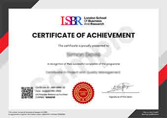
Sample Certificate
Preview the certificate you'll receive upon successful completion of this program.
Get Course Info
Receive the full course guide, pricing details, and enrolment instructions directly in your inbox.
Check your inbox!
Course details have been sent to your email.
Get Your Employer to Sponsor This Programme
Many employers offer professional development budgets. We make it easy for your company to invest in your growth with corporate invoicing and bulk enrolment options.
Email Template for Your Manager
Dear [Manager's Name],
I would like to request sponsorship for the Global Certificate in GIS Mapping for Disaster Response programme offered by LSBR London - Executive Education.
The programme costs $99 (one-time) and can be completed in 3-4 weeks alongside my regular duties.
Key benefits to our team:
- Immediately applicable skills
- Globally recognised certificate
- Corporate invoice available
Best regards,
[Your Name]
What People Say About Us
Hear from our students about their experience with the Global Certificate in GIS Mapping for Disaster Response at LSBR London - Executive Education.
James Thompson
United Kingdom"The course content was incredibly comprehensive, providing a solid foundation in GIS mapping techniques specifically tailored for disaster response scenarios. I gained valuable practical skills that will undoubtedly enhance my ability to contribute effectively in emergency management roles."
Hans Weber
Germany"Since completing the Global Certificate in GIS Mapping for Disaster Response, I've been able to apply my new skills in real-world scenarios, enhancing my ability to respond effectively to natural disasters. This certificate has significantly boosted my career prospects in the field of emergency management, opening up new opportunities for me."
Ryan MacLeod
Canada"The course structure is well-organized, providing a comprehensive overview of GIS mapping techniques specifically tailored for disaster response scenarios, which has significantly enhanced my understanding and practical skills in this field."
Your Path to Certification
Four simple steps from enrolment to your globally recognised certificate
Enrol Online
Complete your enrolment in under 2 minutes with secure checkout
Start Learning
Get instant access to all course materials and start at your own pace
Complete Modules
Work through the curriculum with expert support available throughout
Get Certified
Receive your LSBR London certificate recognised across 180+ countries
LSBR London by the Numbers
Join a global community of professionals advancing their careers
Students Enrolled
Countries Represented
Average Rating
Career Progression
Join Thousands Who Transformed Their Careers
Our graduates consistently report measurable career growth and professional advancement after completing their programmes.
Still deciding?
Join 23,000+ professionals who advanced their careers. Enroll today and start learning immediately.
Enroll NowSecure payment • Instant access • Certificate included