
Postgraduate Certificate in Geometric Database Maintenance and Troubleshooting
Gain advanced skills to design, maintain, and troubleshoot complex geometric databases, boosting efficiency, data integrity, and
Postgraduate Certificate in Geometric Database Maintenance and Troubleshooting
Programme Summary
This rigorous postgraduate certificate addresses the critical need for robust spatial data integrity within complex enterprise environments. It targets experienced database administrators, GIS specialists, and software engineers who manage large-scale geometric datasets requiring precision and reliability. The curriculum delves into advanced spatial indexing structures, topology validation rules, and error detection algorithms essential for maintaining geometric consistency. Participants engage with industry-standard spatial database management systems to diagnose and resolve intricate data corruption issues. The programme demands a solid foundation in relational database theory and prior exposure to coordinate reference systems.
Learners master the technical nuances of spatial query optimisation and performance tuning for geometric operations. They acquire proficiency in automated troubleshooting frameworks that identify topological errors such as overlapping polygons or null geometries. The course emphasises the implementation of rigorous data cleaning pipelines to ensure long-term database health and accuracy. Students develop expertise in scripting custom validation tools using SQL extensions and Python libraries tailored for spatial analysis. They also learn to interpret execution plans to pinpoint bottlenecks in spatial join operations and distance calculations.
Graduates emerge as indispensable assets capable of safeguarding organisational spatial infrastructure against data degradation. This qualification significantly enhances employability in sectors reliant on precise location intelligence, including logistics, urban planning, and telecommunications. Professionals demonstrate the ability to reduce system downtime by proactively identifying and rectifying geometric anomalies before they impact end-users. The credential signals a high level of technical competence in maintaining complex spatial data ecosystems. Employers value the candidate’s proven capability to ensure data reliability and operational efficiency in mission
Learning Outcomes
The Postgraduate Certificate in Geometric Database Maintenance and Troubleshooting addresses a critical gap in modern data infrastructure management. As organisations increasingly rely on spatial data for logistics, urban planning, and environmental monitoring, the integrity of geometric databases becomes paramount. This rigorous programme equips professionals with the advanced technical expertise required to maintain, optimise, and troubleshoot complex spatial information systems.
Curriculum content focuses on the intricate architecture of spatial indices, efficient query processing for high-dimensional data, and robust error-correction protocols for geometric primitives. Students engage with industry-standard platforms, learning to diagnose performance bottlenecks within large-scale geospatial repositories. The course emphasises practical application through simulated crisis scenarios, where participants must rapidly identify and rectify data corruption or indexing failures. Such hands-on experience ensures graduates possess the confidence to manage live production environments effectively.
Graduates apply these specialised skills to enhance data reliability across sectors including telecommunications, defence, and smart city development. By ensuring precise spatial accuracy, they enable organisations to make informed, location-driven decisions with minimal risk. The ability to maintain seamless database operations directly correlates with reduced operational downtime and improved analytical outcomes.
Career prospects for certificate holders are extensive and rewarding. Alumni frequently secure roles as Senior Spatial Database Administrators, Geospatial Data Engineers, or IT Infrastructure Specialists within multinational corporations and government agencies. These positions demand a rare combination of deep technical knowledge and strategic problem-solving ability. The programme serves as a distinguished credential for those seeking to advance into leadership roles within
Programme Features
Industry-Aligned Curriculum
Developed with industry leaders for job-ready skills
Globally Recognised Certificate
Recognised by employers across 180+ countries
Flexible Online Learning
Study at your own pace with lifetime access
Instant Access
Start learning immediately, no application process
Constantly Updated Content
Latest industry trends and best practices
Career Advancement
87% report measurable career progression within 6 months
Course Modules
- Spatial Indexing Structures: Examines R-trees, Quad-trees, and other hierarchical structures for efficient geometric data retrieval.: Geometric Query Optimization: Analyzes algorithms for optimizing range, nearest-neighbor, and spatial join queries in large datasets.
- Data Integrity and Validation: Focuses on techniques for detecting topological errors, slivers, and inconsistencies in spatial records.: Concurrency and Transaction Management: Explores locking mechanisms and isolation levels specific to high-volume geometric database updates.
- Performance Tuning and Diagnostics: Covers tools and strategies for identifying bottlenecks, analyzing execution plans, and improving throughput.: Backup, Recovery, and Migration: Details procedures for safely archiving spatial data, restoring from failures, and migrating between database systems.
What's Included in This Programme
Here is what you get when you enrol with LSBR London
Programme Facts
Audience: Senior IT professionals managing complex geometric data systems.
Prerequisites: Undergraduate degree in Computer Science or related discipline.
Outcomes: Mastery of advanced database troubleshooting and maintenance techniques.
Ready to advance your career?
Join thousands of professionals who have transformed their careers with LSBR London. Enrol today and start learning immediately.
Why Study This Programme
Pursuing a Postgraduate Certificate in Geometric Database Maintenance and Troubleshooting of Geometric Databases represents a strategic investment for technical professionals seeking to distinguish themselves within the increasingly competitive data engineering landscape. This specialised qualification addresses a critical market gap by focusing on the intricate spatial data structures that underpin modern GIS, urban planning, and autonomous navigation systems.
Enhanced Technical Proficiency: Candidates acquire advanced diagnostic skills for complex spatial indexing failures, enabling them to resolve latency issues in high-volume geospatial applications with precision. This hands-on expertise directly translates into improved system reliability for enterprise clients.
Career Differentiation: As organisations increasingly rely on location intelligence, possessing certified expertise in geometric data integrity sets professionals apart from generalist database administrators. This niche specialisation often leads to accelerated promotion trajectories and eligibility for senior architectural roles.
Operational Efficiency Gains: Graduates learn to implement proactive maintenance protocols that reduce downtime significantly. By mastering automated troubleshooting scripts for spatial queries, professionals can optimise resource allocation, thereby delivering measurable cost savings to their employers.
Industry Relevance: The curriculum aligns with current industry standards for spatial data management, ensuring that learners remain at the forefront of technological advancements. This relevance guarantees long-term employability in sectors such as logistics, telecommunications, and smart city development.
This programme equips professionals with the rigorous analytical frameworks necessary to manage the complexities of modern spatial data infrastructure, fostering both personal growth
"This programme gave me the confidence and credentials to secure a senior role. Highly recommend LSBR London."
— Sarah M., United Kingdom
Course Brochure
Download our comprehensive course brochure with all details
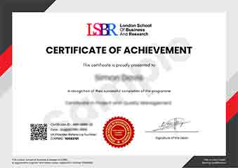
Sample Certificate
Preview the certificate you'll receive upon successful completion of this program.
Get Course Info
Receive the full course guide, pricing details, and enrolment instructions directly in your inbox.
Check your inbox!
Course details have been sent to your email.
Get Your Employer to Sponsor This Programme
Many employers offer professional development budgets. We make it easy for your company to invest in your growth with corporate invoicing and bulk enrolment options.
Email Template for Your Manager
Dear [Manager's Name],
I would like to request sponsorship for the Postgraduate Certificate in Geometric Database Maintenance and Troubleshooting programme offered by LSBR London - Executive Education.
The programme costs $149 (one-time) and can be completed in 3-4 weeks alongside my regular duties.
Key benefits to our team:
- Immediately applicable skills
- Globally recognised certificate
- Corporate invoice available
Best regards,
[Your Name]
What Our Students Say
Hear from our students about their experience with the Postgraduate Certificate in Geometric Database Maintenance and Troubleshooting at LSBR London - Executive Education.
James Thompson
United Kingdom"The modules dive deep into spatial indexing, topology validation, and performance tuning, presenting the theory in a clear, well‑structured way that made complex concepts surprisingly accessible. Hands‑on labs with real‑world GIS datasets gave me confidence to troubleshoot and optimize geometric databases, and I’ve already started applying those skills to improve query speed in my current role."
Priya Sharma
India"The program gave me a solid grasp of spatial indexing, data integrity checks, and performance tuning that I could apply immediately to the GIS projects at my firm, cutting query times by half. Since graduating, I’ve been promoted to lead the geospatial data team and now consult on large‑scale database migrations, thanks to the practical, industry‑focused skills I gained."
Rahul Singh
India"The modular layout of the program made it easy to progress from foundational concepts to advanced troubleshooting techniques, and each unit built logically on the last. The comprehensive coverage of spatial indexing, data integrity checks, and real-world case studies gave me practical tools I can apply immediately in my GIS projects, boosting both my confidence and professional credibility."
Your Certification Journey
Four simple steps from enrolment to your globally recognised certificate
Enrol Online
Complete your enrolment in under 2 minutes with secure checkout
Start Learning
Get instant access to all course materials and start at your own pace
Complete Modules
Work through the curriculum with expert support available throughout
Get Certified
Receive your LSBR London certificate recognised across 180+ countries
LSBR London by the Numbers
Join a global community of professionals advancing their careers
Students Enrolled
Countries Represented
Average Rating
Career Progression